Stacey and I have been thinking about maps.
What lies beneath all the lines? What stories are told? Whose stories? What stories are left untold? What happened here that is not recorded? What about here?

As we discussed it, we realized we wanted a couple of things that couldn’t be met with a single piece. Interactivity, meticulous craftiness, participatory, conceptual simplicity, looseness, and total OCD dorkiness.
So we decided, after some discussion, to do three related pieces.

(1) A Crafted Piece
A fully constructed map with the appearance of a quad contour map, whose lines are composed of stories. This is the subtlest and finest-crafted of the three pieces.
Mounted on layers of glass with contour elevations mounted above or below as appropriate. Handwritten stories in tiny tiny letters are laid along where the contour lines would be.
Since this is an invented landscape, we didn’t feel any need to isolate the stories to a particular place, or to make the stories reflect particular narratives. So we will be gathering stories, our own and others, hopefully reflecting a diversity of view points and otherwise untold stories.
For me, an important part of the story of any landscape are stories of resistance, indigenous peoples, the folks whose stories were erased by the victors, colonialists, and capitalists who replaced them.
(2) Collaboratively Created
In this piece we wanted viewers to be able to participate and help make an ever-evolving piece.
Layers of transparencies on which contributors write their stories along the contour lines. Transparencies are placed in a frame where all the completed layers can be seen overlaid to create a composite map of everyone’s mental, emotional, and historic landscape.
Blank transparencies are presented on a clipboard with contour lines (and instructions) on maps beneath. Layers can be rearranged in the frame (kinda similar to the way hanging combs can be arranged in a beehive.
Again, this is fictional landscape and so everyone’s stories make a collaborative map of the mind and heart.
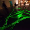
(3) Technological Intervention
Here we wanted something dynamic and highly-interactive.
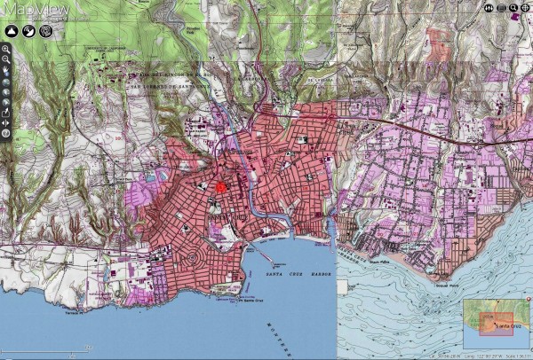
Participants overlay their stories of names onto a familiar landscape — possibly the city of Santa Cruz represented as a simplified quad map — calling into question the idea that there is one dominant or “right” story (a general theme of the series). The resulting map is projected live on the wall of the gallery.
Participants select a line, a feature, a road, a street, or a name that they want to replace. Then they type the new name, or new story to replace the feature they’ve selected. For instance, if a visitor chose the line of a river, their story (maybe placed-based!) would replace the actual line of the river, writ small and repeated as necessary. If someone selected a street name, they could rename the street to their new name.
Obviously, this piece is the most high-tech and requires research, programming, and technical assistance. If the technology were chosen well, it could be presented online via a standard web browser as well, using virtually any map.
We have already done some test pieces in service of (1) and so things progress. Yeah, art! Yeah, collaboration!